

Bushfire.io
Screenshots


|
Developer
|
Bushfireio |
|
Category
|
Weather |
|
Installs
|
510,000,000 |
|
Version
|
1.0.3 |
|
Content Rating
|
0 |
|
Price
|
Free |
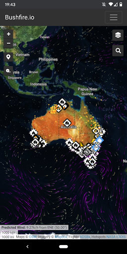
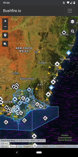
We integrate data from a variety of sources and provide a national view of fire events, fire hotspots, road closures, weather, and other critical bushfire information.
For fires, Bushfire.io now integrates information from a variety of feeds to show on one map:
- A national view of bushfire warnings and fire incidents.
- Detailed incident information (where available) for NSW, VIC, WA and ACT.
- Closed or hazardous roads for NSW and VIC.
- Recently burnt areas for VIC, QLD, and TAS.
- Bureau of Meteorology near-real-time weather observations.
- NOAA wind forecast (predicted wind) for the particle overlay.
- Major fire aircraft from ADSBx.
- Hotspots via NASA from NOAA-20, Suomi, Aqua and Terra.
100% Safe
Explore More Similar Apps


